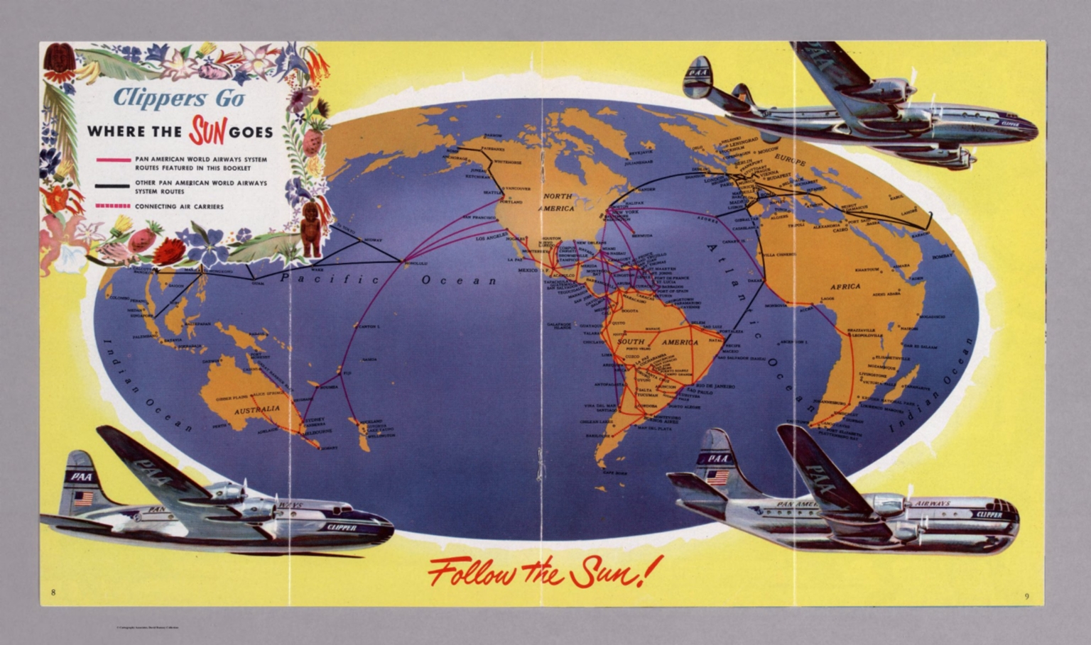
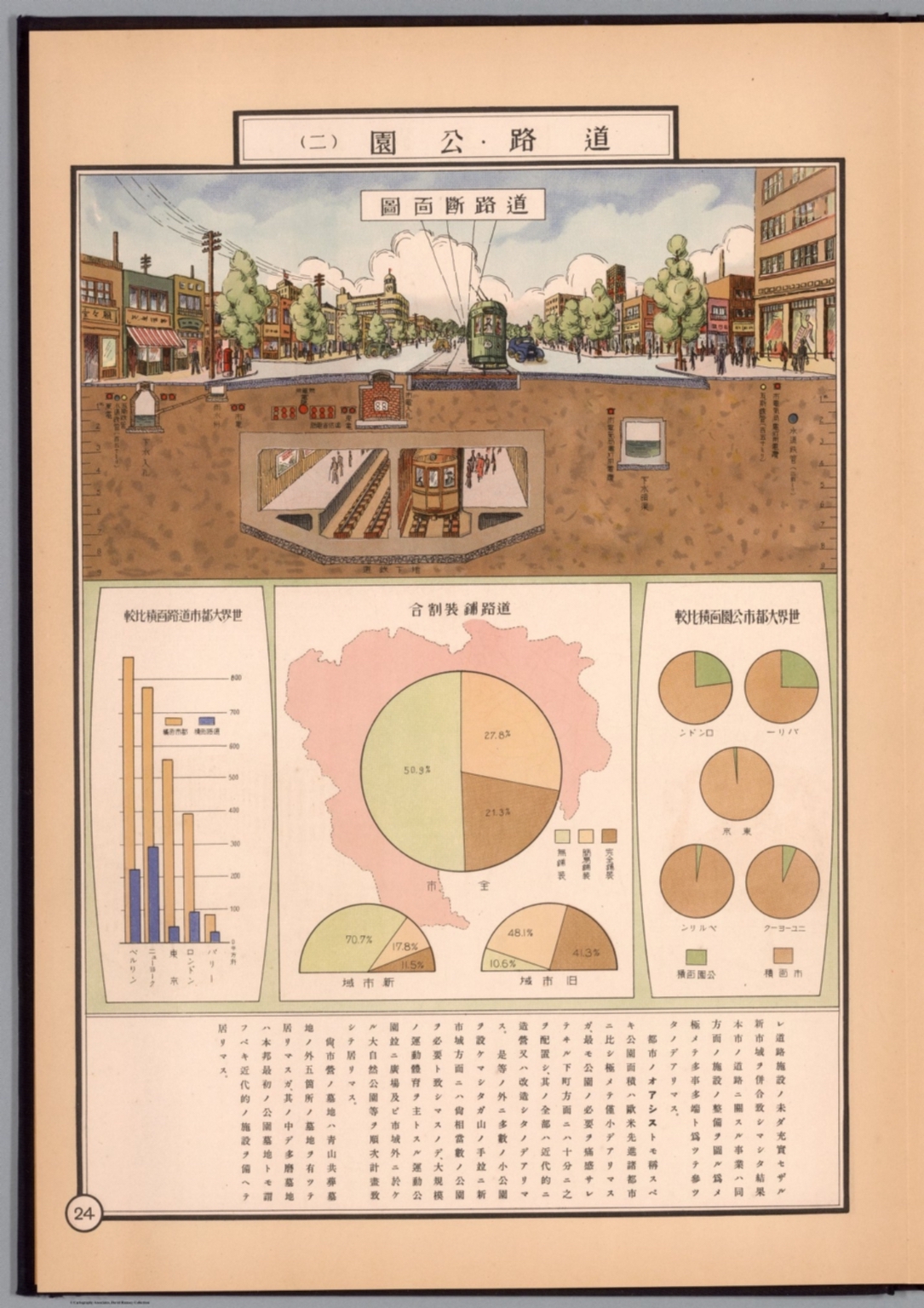
The world has changed dramatically over the past 500 years, albeit not quite as dramatically as how we see the world. That’s just what’s on display at the David Rumsey Map Collection, whose more than 131,000 historical maps and related images are available to browse (or download) free online. Since we last featured it here on Open Culture, the collection has added at least 40,000 items to its digital holdings, making it an even more valuable resource for not just understanding how humanity has viewed the world throughout the ages, but how we’ve imagined it — and, for that matter, how we’ve imagined other worlds from Mars to Narnia to Krypton.
“Imaginary maps” is just one of the categories through which you can explore the David Rumsey Map Collection. There are also tags for newspaper maps, timelines, city maps, celestial maps, data visualizations, children’s maps, and more varieties besides.
If you’d prefer a more traditional form of organization, you can search for maps of specific geographical regions: North America, South America, Europe, Asia, Africa, Australia, Antarctica, the Pacific, the Arctic, and of course, the world. If it’s the last item you’re interested in, apart from the considerable two-dimensional holdings, the interactive globes constitute a gallery of their own, and there you can view ones made between the mid-sixteenth century and just last year from every possible angle.

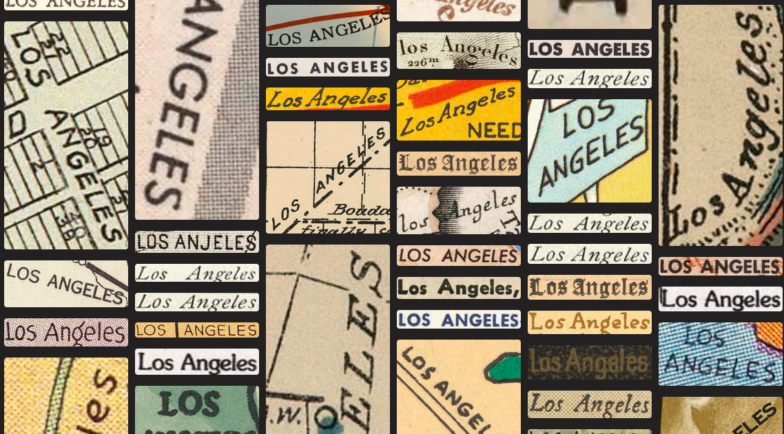
Among the site’s new features is a “search by text-on-maps” feature, which you can activate by clicking the “by Text on Maps” button next to the search window at the top of the page. This lets you compare and contrast the ways particular places have been labeled on the variety of maps in the collection: not just proper names like Cairo, Madrid, and Yosemite, but also more general terms like “gold mine,” “lighthouse” or “dragons.” Arguably, we look at maps more often here in the twenty-first century than we ever did before, though seldom if ever do we depart from whichever mapping app we happen to keep on our phones. It’s worth stepping back in cartographical time to remember that there were once as many ways of understanding the world as there were depictions of it.
Related content:
Oculi Mundi: A Beautiful Online Archive of 130 Ancient Maps, Atlases & Globes
40,000 Early Modern Maps Are Now Freely Available Online (Courtesy of the British Library)
Based in Seoul, Colin Marshall writes and broadcasts on cities, language, and culture. His projects include the Substack newsletter Books on Cities, the book The Stateless City: a Walk through 21st-Century Los Angeles and the video series The City in Cinema. Follow him on Twitter at @colinmarshall or on Facebook.
Leave a Reply