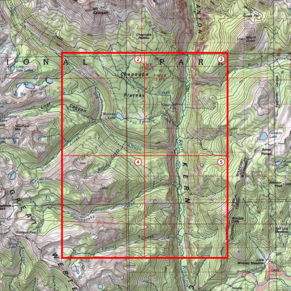
Briefly noted: National Geographic has built a web interface that allows anyone to find any quad in the United States, and then download and print it. During past decades, these quads (topographic maps) were printed by the United States Geological Survey (USGS) on giant bus-sized presses. But now they’ve been pre-processed to print on standard printers found in most homes.
To access the maps, click here, pick a location, then start zooming in until you see red icons. Then choose the geographically-appropriate icon and print/download a map in PDF format.
If you would like to sign up for Open Culture’s free email newsletter, please find it here. It’s a great way to see our new posts, all bundled in one email, each day.
If you would like to support the mission of Open Culture, consider making a donation to our site. It’s hard to rely 100% on ads, and your contributions will help us continue providing the best free cultural and educational materials to learners everywhere. You can contribute through PayPal, Patreon, and Venmo (@openculture). Thanks!
Related Content:
The History of Cartography, the “Most Ambitious Overview of Map Making Ever,” Now Free Online
New York Public Library Puts 20,000 Hi-Res Maps Online & Makes Them Free to Download and Use
Hello, when I tried to “Suggest a Link”, there was a PHP problem with the form, so I hope this comment goes through :)
I wanted to point your attention to this Ancient Greek course recently posted by the Center for Hellenic Studies (a Harvard affiliate in Wash D.C.), taught by a Prof Emeritus from Brandeis:
https://www.youtube.com/playlist?list=PLq5ea-jR9u2puDaLoRL-nBkpwrkURbLjT
The textbook used is:
Hansen, Hardy, and Gerald Quinn. Greek. An Intensive Course. 2nd rev. ed. New York: Fordham University Press, 1992.
Cool maps
Can you send me a free foldable map of the World for educational purposes! name=Norma Haney Address: 46565 Harry Byrd Hwy #350 Sterling,CA 29164