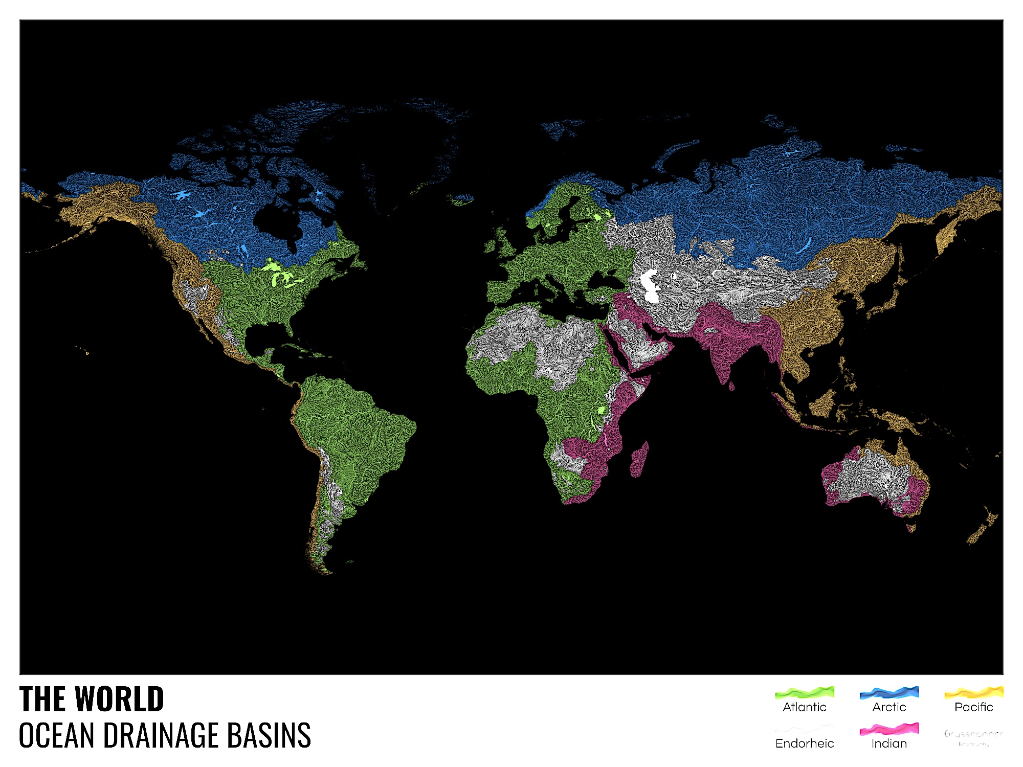
Even if you’ve never traveled the seas, you’ve surely known at least a few rivers in your time. And though you must be conscious of the fact that all of those rivers run, ultimately, to the sea, you may not have spent much time contemplating it. Now, thanks to the work of mapmaker and data analyst Robert Szucs, you won’t be able to come upon at a river without considering the particular sea into which it flows. He’s created what he calls “the first ever map of the world’s rivers divided into ocean drainage basins,” which appears just above.
This world map “shows, in different colors, all the rivers that flow into the Atlantic, Arctic, Indian or Pacific oceans, plus endorheic river basins which never reach the coast, mostly due to drying up in desert areas.”
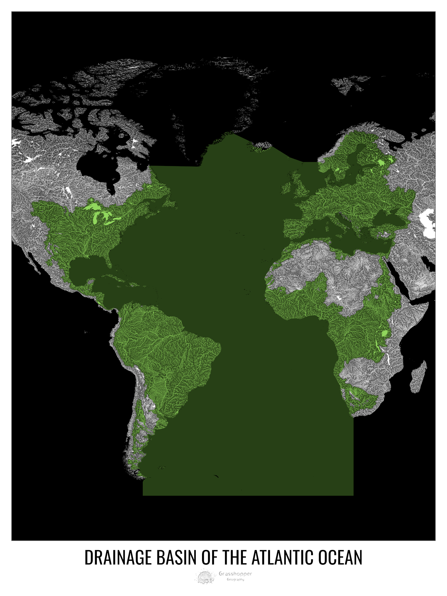
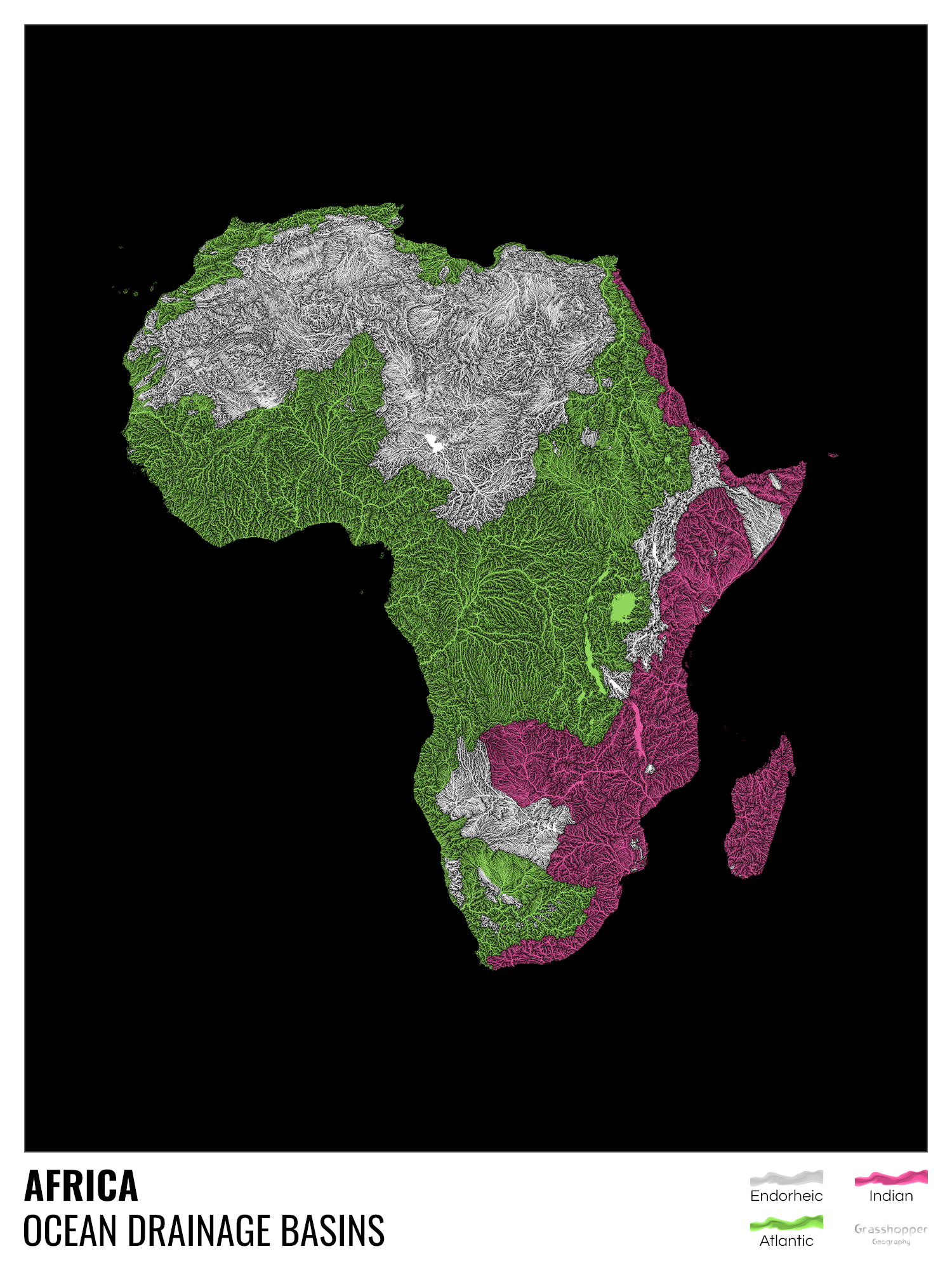
Szucs has also broken it down into “a set of 43 maps in this style for different countries, states and continents,” all of them available to download (and to purchase as large-format posters) from his web site Grasshopper Geography.
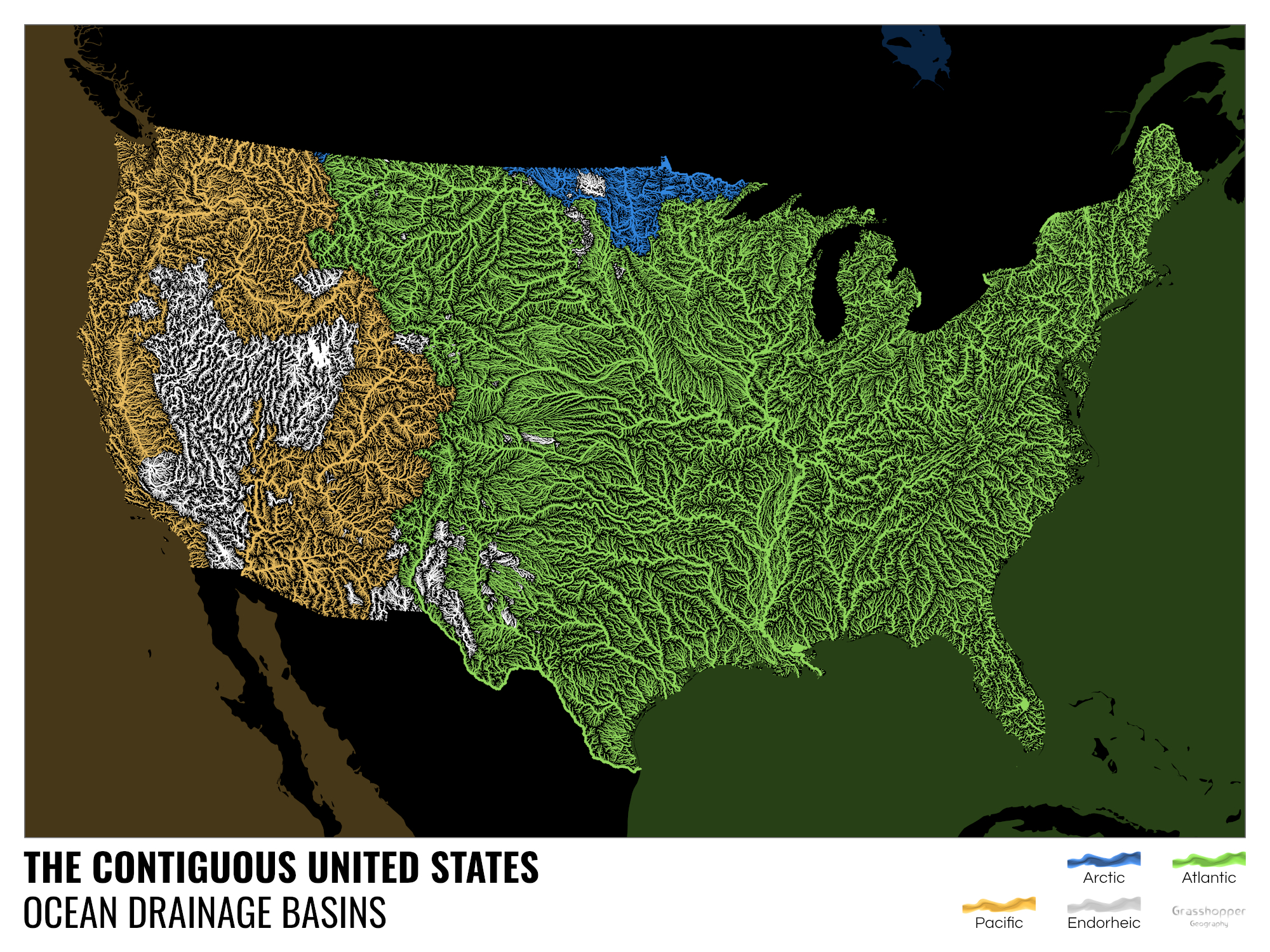
We previously featured Szucs here on Open Culture back in 2017, when he published a river-and-stream-visualizing map of the United States made according to a similarly colorful and informative scheme. Examining that work of information design gave me a richer context in which to imagine the rivers around which I grew up in Washington State — the Sammamish, the Snoqualmie, the Columbia — as well as a clearer sense of just how much the United States’ larger, much more complex waterway network must have contributed to the development of the country as a whole.
Of course, having lived the better part of a decade in South Korea, I’ve lately had less reason to consider those particular geographical subjects. But Szucs’ new global ocean drainage maps have brought related ones to mind: it will henceforth be a rare day when I ride a train across the Han River (one of the more sublime everyday sights Seoul has to offer) and don’t imagine it making its way out to the Pacific — the very same Pacific that was the destination of all those rivers of my west-coast American youth. Oceanically speaking, even a move across the world doesn’t take you quite as far as it seems.
Related content:
All the Rivers & Streams in the U.S. Shown in Rainbow Colors: A Data Visualization to Behold
That Time When the Mediterranean Sea Dried Up & Disappeared: Animations Show How It Happened
A Radical Map Puts the Oceans — Not Land — at the Center of Planet Earth (1942)
Tour the Amazon with Google Street View; No Passport Needed
Based in Seoul, Colin Marshall writes and broadcasts on cities, language, and culture. His projects include the Substack newsletter Books on Cities, the book The Stateless City: a Walk through 21st-Century Los Angeles and the video series The City in Cinema. Follow him on Twitter at @colinmarshall or on Facebook.
Leave a Reply