We all remember the world maps that hung on the walls of our classrooms, the ones at which we spent countless hours staring when we couldn’t focus on the lesson at hand. Did we look at them and imagine fleeing school for one of the far-off lands they pictured — or indeed finding a way to escape planet Earth itself? Such time-passing fantasies unite schoolchildren of all eras, though some eras have provided their schoolchildren richer material to fire up their imaginations than others.
Take, for instance, the rich, vivid maps of Yaggy’s Geographical Study, which depict not just the world but the cosmos, and which were first produced for classrooms in 1887. The eponymous Levi Walter Yaggy, says Boston Rare Maps, “seems to have viewed himself as an innovator and entrepreneur tapping into a transformational moment in American education.”
An advertisement for Yaggy’s Chicago-based Western Publishing House lays out the company’s mission: “Instead of offering the public old things ‘made over,’ it has come to the help of teachers and schools with a series of appliances which in design, mechanism and manner of illustration, are new, elegant and practical.”
It also points to “the enthusiasm which has been aroused in educational circles by this new departure” as “proof of the fact that teachers are tired of stereotyped and worn-out means of school-room illustration.”
One can well imagine the enthusiasm aroused among schoolchildren of the late 19th century when the teacher brought out Yaggy’s Geographical Study, a plywood box filled with colorful, large-format maps measuring roughly two by three feet that revealed a wealth of knowledge about the Earth and outer space.
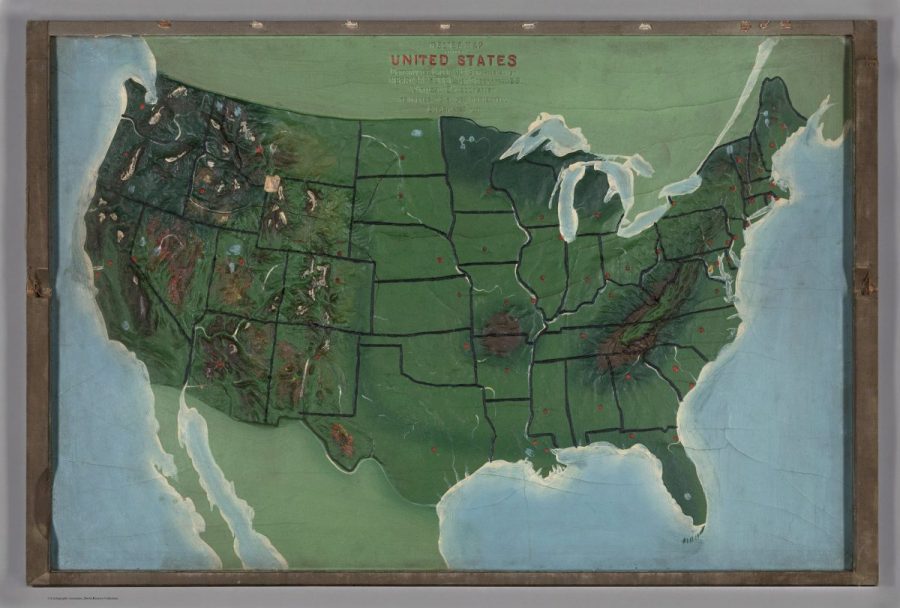
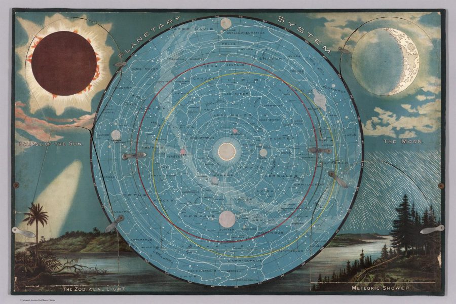
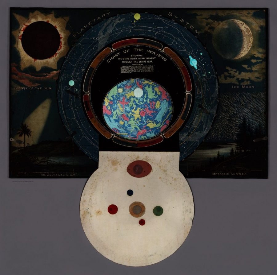
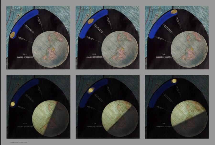
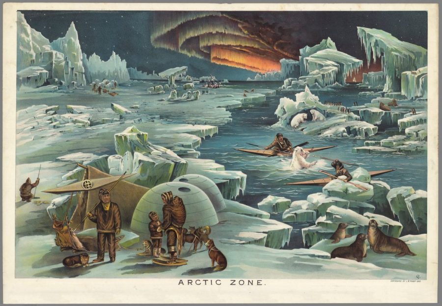
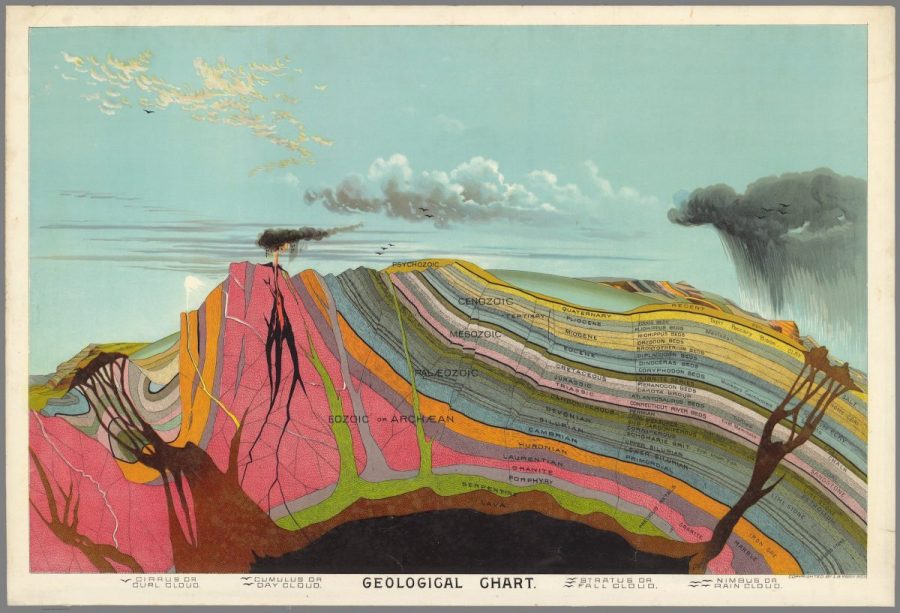
The David Rumsey Map Collection has digitized and made available to download everything that came inside, including the cross-section of the geological strata of “pre-Adamite Earth”; the illustration of the civilizations of five climatic zones “Showing in a Graphic Manner the Climates, Peoples, Industries & Productions of The Earth”; the 3D relief map of the United States built into the back of the box; and the jewel in the crown of Yaggy’s Geographical Study, the star chart.
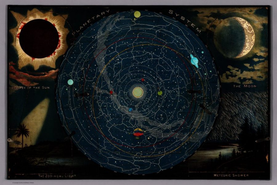
The star chart, as National Geographic’s Greg Miller describes it, “has five panels held in place by tiny metal latches. Each panel can be opened to reveal a more detailed diagram. One shows the phases of the moon, for example, while another includes a slider to illustrate how the position of the sun changes relative to Earth with the seasons,” the whole thing “designed to highlight certain features when a bright light is placed behind it.”
Despite displaying here and there what we now regard as scientific inaccuracies (Miller points to how the elliptical orbit of planets are shown as circles) and unfashionable social attitudes, Yaggy’s Geographical Study also embodies the spirit of its time in a way that still fires up the imagination. The golden age of exploration had already entered its final chapter and space travel remained the stuff of science fiction (a genre that had only recently taken the form in which we know it today), but with maps like these on the wall, no daydreaming student of the 1880s could doubt that reality still offered much to discover.
Related Content:
3D Map of Universe Captures 43,000 Galaxies
How Leonardo da Vinci Drew an Accurate Satellite Map of an Italian City (1502)
Based in Seoul, Colin Marshall writes and broadcasts on cities, language, and culture. His projects include the book The Stateless City: a Walk through 21st-Century Los Angeles and the video series The City in Cinema. Follow him on Twitter at @colinmarshall, on Facebook, or on Instagram.
Leave a Reply